"The wind speed increased by 100 mph in only 24 hours," said CNN meteorologist Brandon Miller. "Which is nearly three times what is needed to be considered rapid intensification."
This is the "most intensification by a tropical cyclone in the western North Pacific in 18 hours since Yates in 1996," tweeted Colorado State University meteorologist Philip Klotzbach.
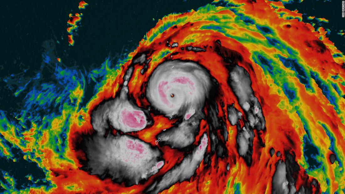
The super typhoon is near the Northern Mariana Islands with sustained winds of 160 mph -- the equivalent of a Category 5 hurricane.
It will track between the islands of Anatahan and Sarigan, according to the latest forecast from the Joint Typhoon Warning Center.
Forecast near Japan as a strong typhoon Saturday
It is forecast to approach south-central Japan on Saturday morning local time as a typhoon, with winds equivalent to that of a Category 3 hurricane. You can track the forecast path with CNN's storm tracker here.
"Conditions in Japan will deteriorate through the day with the worst moving through central Japan late Saturday into Sunday local time," said CNN meteorologist Monica Garrett.
Rainfall of over 250 millimeters (nearly 10 inches) is possible for some locations in south-central Japan.
Hagibis is still five days away from impacting Japan.
The Joint Typhoon Warning Center has low confidence in its forecast on Friday and Saturday, so this powerful and dangerous super typhoon needs to be watched closely in the coming days.
No comments:
Post a Comment