-
Here's what to expect from the storm before it makes landfall
-
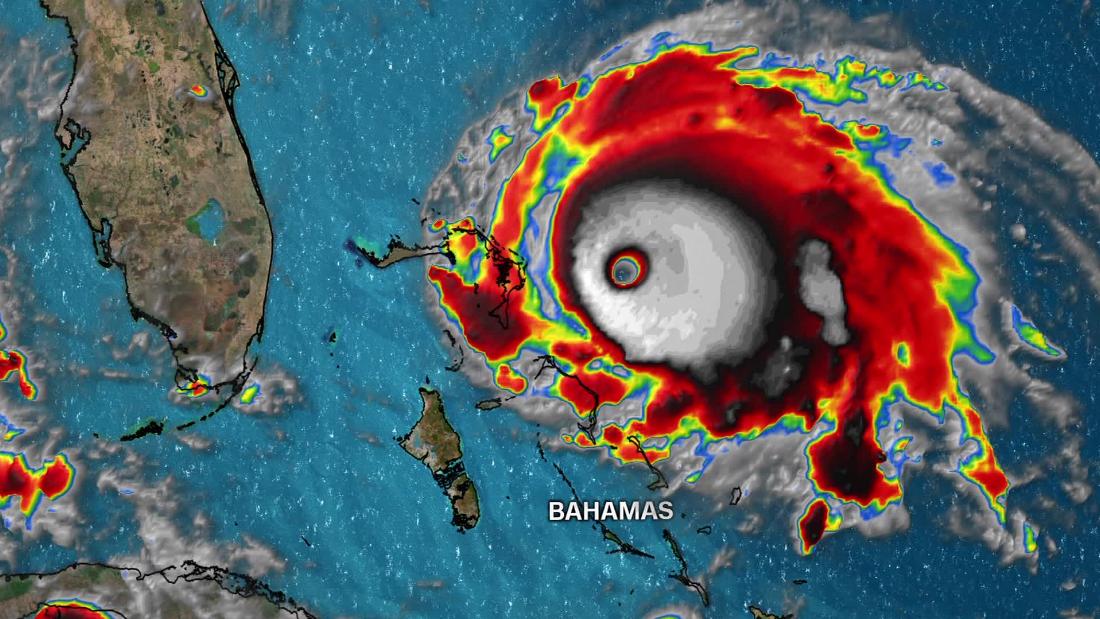
- Landfall is possible in the North Bahama islands as a Category 4 hurricane
- Hurricane conditions arrive and continuously lash the Abaco Islands and Grand Bahama
- The storm's forward movement likely slows to almost a crawl over North Bahama
- Life-threatening storm surge, hurricane-force winds and very heavy rainfall will pound these northern islands
-
- Dorian creeps toward Florida's east coast
- Hurricane conditions are likely for anyone within 30 miles from the storm's center
- Tropical-storm-force winds likely arrive along Florida coast
- It continues to rain in the northwestern Bahamas, where up to 12 to 24 inches of rain is expected to fall, with isolated amounts of 30 inches
-
- Landfall is still a distinct possibility in Florida as some forecast models have shifted west again
- The storm turns northward and moves up the coast of Florida or more likely offshore and along the coast
-
- The storm continues to produce hurricane-force winds as it heads north with some more weakening forecast
- There is an increasing risk of strong winds and dangerous storm surge along the coasts of Georgia, South Carolina and North Carolina
- Flooding rainfall continues from southern Florida into Georgia
- Closest approach to Georgia and not out of the realm of possibility for a landfall
-
- The closest approach to the Carolina coast and the possibility of a landfall
-
- The storm is near the outer banks of North Carolina
All times are local
Updated 8:00 AM ET, Sun September 1, 2019
No comments:
Post a Comment