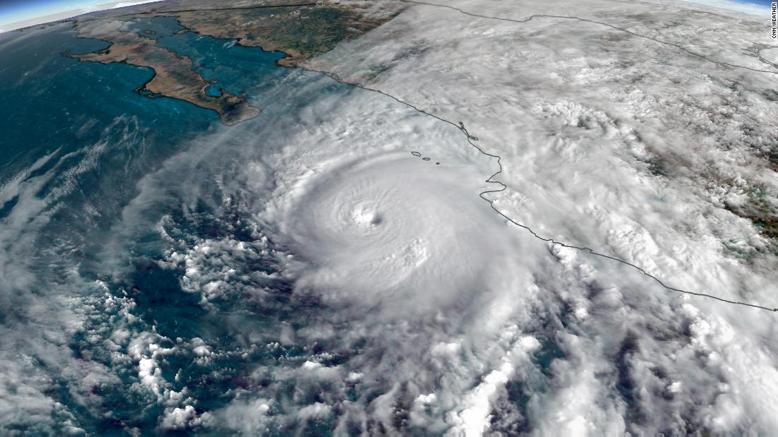
Winds were at 35 mph and the storm was moving toward the northeast through central Mexico. The storm will continue to weaken as it hits the Sierra Madre mountain range and pumps moisture into northern Mexico and Texas.
Willa was expected to bring life-threatening storm surges, rain and wind to residents on Mexico's Pacific shore, according to the US National Hurricane Center.
Once a Category 5 hurricane, Willa had weakened before landfall to a Category 3 storm, but still had maximum sustained winds of 120 mph (195 kilometers per hour).
Forming Saturday, Willa went from a tropical storm to a Category 5 hurricane in two days in what the hurricane center called "explosive" strengthening. In one 24-hour period, its winds spiked by 80 mph.
Forecasters were concerned about storm surge and rainfall.
"Near the coast, the surge will be accompanied by large and destructive waves," the hurricane center said. "Rainfall will cause life-threatening flash flooding and landslides."
Rainfall totals were expected to reach 18 inches in portions of the Mexican states of Durango, Jalisco, Nayarit and Sinaloa.
Willa made landfall Tuesday in Isla del Bosque and headed toward Mazatlan, Sinaloa, according to the Mexico National Water Commission.
Strong storms were also expected in Chihuahua, Guerrero, Veracruz, Baja California, and Chiapas. Authorities advised of possible landslides.
Puerto Vallarta's Mayor, Arturo Dávalos, spoke to CNN en Español on Tuesday and said evacuations had already begun and that two shelters were available.
Davalos also said that approximately 650 tourists of various nationalities were taken to a safe location in a coordinated effort with the consulates of Canada and the United States and are waiting for the current alert to be lifted.
A tourist in Nayarit, where Willa was expected to hit hard, seemed to have been caught off guard by the hurricane, telling CNN en Español that he wasn't expecting to have any bad weather, just to enjoy the time in the sun and at the beach. He added that the storm wasn't going to dampen his vacation but said that if it did get bad, he would worry about his family.
Mexico's office of national defense posted pictures on its Twitter account of temporary shelters.
Willa had been a danger for forecasters as well. An aircraft with the Air Force Reserve's Hurricane Hunters was forced to turn around Monday over concerns for its onboard equipment after a lightning bolt from one of Willa's outer rain bands blasted it, according to the National Hurricane Center.
In a tweet Monday, Mexican President Enrique Peña Nieto said he had asked the National System of Civil Protection to take all steps necessary to protect those in the hurricane's path as well as those affected by Tropical Storm Vicente, a weaker system tracking south of Willa that's also primed to make landfall Tuesday. Vicente likely will be a tropical depression by the time it comes ashore, the hurricane center said.
Airlines had started moving out of Willa's path. Southwest Airlines had canceled all flights at the international airport in Puerto Vallarta, a resort city in Jalisco state. American Airlines had canceled its flights in Mazatlán, about 275 miles to the north.
Willa's landfall came three years to the day after the strongest hurricane to hit the Pacific coast, Patricia, a Category 5 storm, made landfall in Jalisco.
The back-to-back systems of Willa and Vicente have helped make the 2018 hurricane season in the northeast Pacific one for the record books.
The season is now the most active hurricane season on record using a measurement called accumulated cyclone energy, which combines the number of storms and their intensity through their lifetimes to give an overall measurement of tropical activity in a given region.
There have been 10 major hurricanes this year, including Willa, tying 1992 as the most major hurricanes in the northeast Pacific in one year.
Increasing numbers of major hurricanes, along with a greater propensity of storms to undergo "rapid intensification" are expected consequences of warmer ocean waters resulting from climate change. The ocean waters off Mexico's western coast are running 1 to 2 degrees Fahrenheit above average for late October.
No comments:
Post a Comment